
Pico del Cielo
Trail description
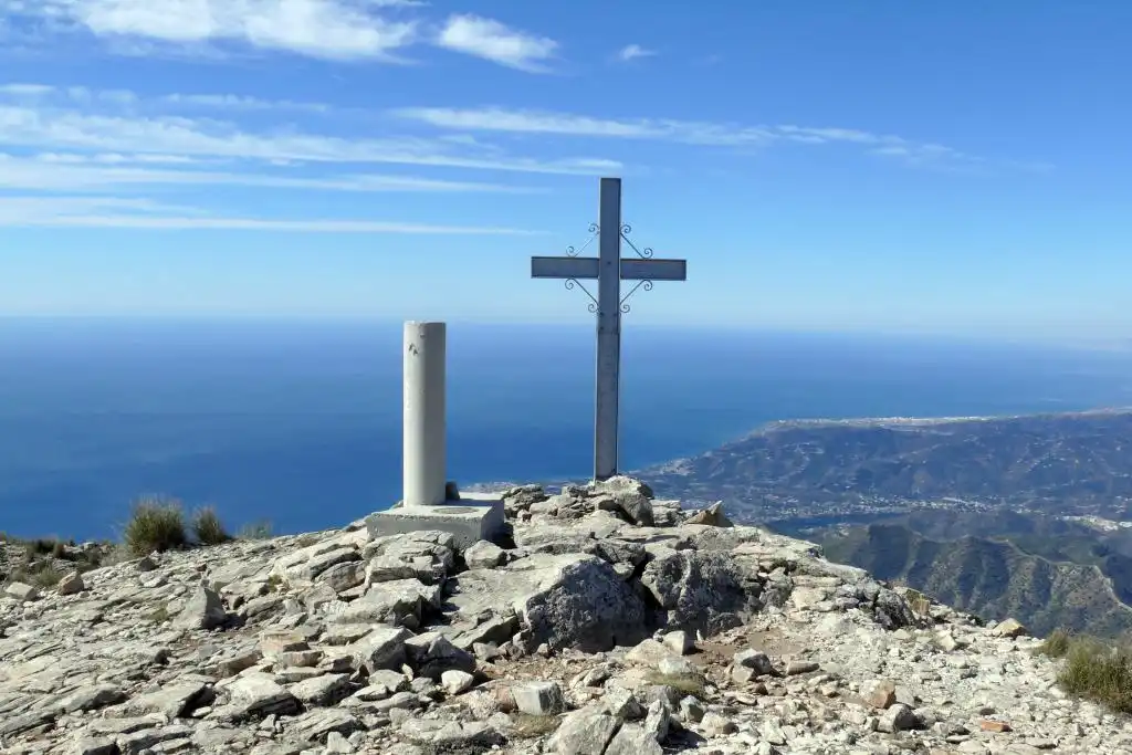
Pico del Cielo, standing at 1,508 metres, is the most iconic mountain in Nerja and one of the most impressive summits in the Sierra Almijara. Its closeness to the sea — barely 6 km in a straight line — creates a truly unique landscape contrast: from the top, on clear days, you can take in the snow-capped peaks of Sierra Nevada, the Mediterranean Sea, and the African coastline all at once.
The route sets off from the car park at the Cueva de Nerja and climbs along what is known as the "Cuesta del Cielo" (Stairway to Heaven trail), a well-marked but demanding path that passes through distinct vegetation zones, from low Mediterranean scrubland up to the pine forests of the higher slopes.
With around 800 metres of total elevation gain, this ascent is a genuine physical challenge. The final stretch to the summit is the most spectacular, with views that open up gradually until you're rewarded with a full 360-degree panorama.
At the top, you'll find a geodesic marker and the remains of an ancient watchtower. The views stretch across the entire Málaga coastline, the Parque Natural de Sierra Tejeda, Almijara y Alhama, and on clear days, the Rif Mountains of Morocco.
How to get there
Starting point: Aparcamiento Cueva de Nerja
Parking: Park next to the Cueva de Nerja car park, start of the route.
Open in Google MapsWarnings
This is a demanding route with 800 metres of elevation gain. There are no water sources along the trail, so carry everything you need. Not recommended in extreme heat or strong winds. Several sections are rocky and steep. Ice can form on the upper slopes during winter.
Recommendations
Plan ahead and check weather conditions before setting out. Wear appropriate clothing and footwear suitable for steep, uneven terrain. It is essential to carry plenty of water (at least 2 litres), food, sunscreen, a hat, and sunglasses. Start early in the morning. Always prioritise safety in areas with rough or exposed terrain.
Points of interest
Vértice geodésico
Summit at 1,508 m with remains of a watchtower
point_of_interestFrequently asked questions
Keep exploring
Distance
14.0 km
Time
6h
Elevation +
1260 m
Elevation −
1260 m
Max alt.
1508 m
Min alt.
250 m