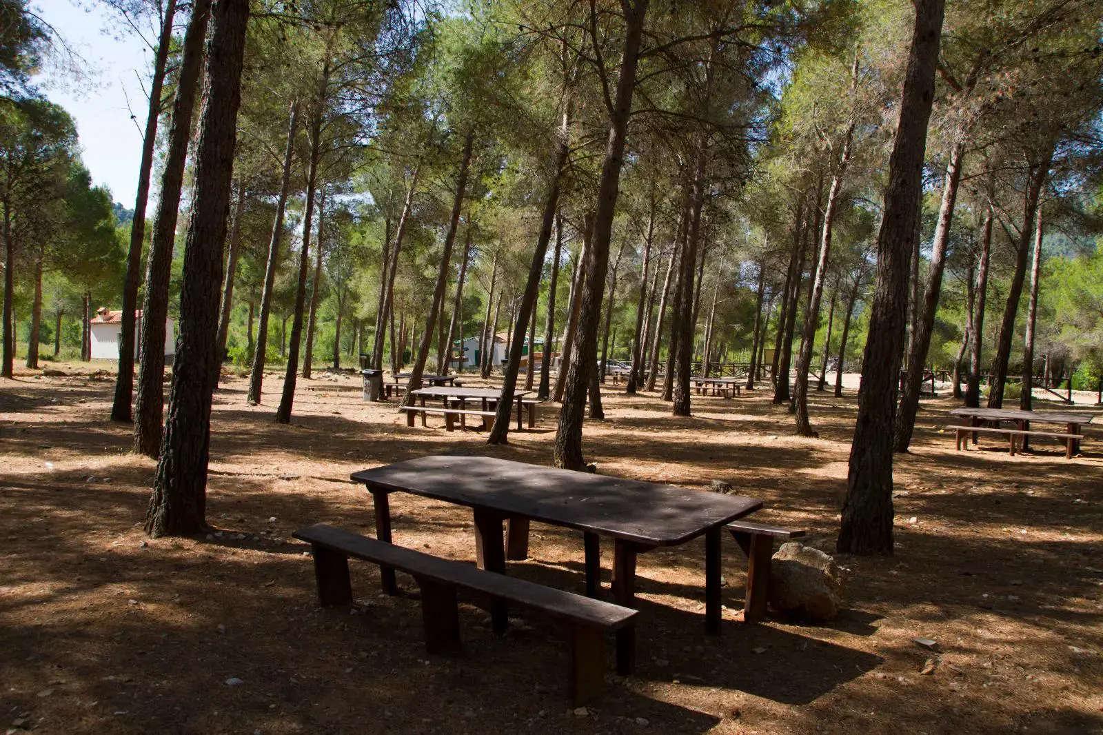
El Pinarillo Walk from the Nerja Caves
Trail description
🚧 Can you drive to El Pinarillo?
The track has a barrier by the Nerja Caves that is usually closed to cars in summer and whenever there is a fire risk, and open in the cooler months depending on the rain (in some years it has stayed closed for much longer). Plan to walk from the caves car park: it is a 4.7 km stroll along the track.
El Pinarillo is Nerja's municipal picnic area in the mountains: tables and barbecues in the shade of a pine wood, with a fountain, at 460 m inside the Sierras de Tejeda, Almijara y Alhama Natural Park. You get there from the Nerja Caves along a wide forest track that follows the Gran Senda de Málaga (GR 249): it is the easiest mountain walk in Nerja and suitable for families.
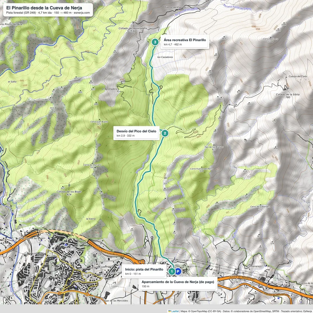
Trail map
Walk facts
- Start
- Nerja Caves car park (150 m).
- Distance
- 4.7 km to El Pinarillo; 9.4 km there and back.
- Elevation
- 310 m of gentle, steady climbing.
- Time
- 1.5 h up and 1 h down; 2.5–3 h with stops.
- Difficulty
- easy: wide gravel track, no difficult sections.
- Facilities
- tables, barbecues and a fountain at the picnic area.
The walk
The track starts by the caves car park and climbs the valley through Aleppo pines and Mediterranean scrub, with the sea further below at every bend. At km 2.9 the Pico del Cielo path branches off to the right; carry straight on. After 4.7 km you reach El Pinarillo. If you still have energy, the Fuente del Esparto spring is one kilometre further up the same track.
The barbecues
They can only be used outside the fire-risk season and when there is no warning from the Junta or the town council. In summer, and whenever there is a risk, fires are forbidden. Take your rubbish home.
Getting there and parking
The Nerja Caves are 4 km from the town centre on the Maro road; buses from Nerja to Maro stop by the caves. The caves car park is paid and attended during the caves' opening hours.
Sources: Nerja town council notices on closing vehicle access to the El Pinarillo municipal picnic area (April 2023 fire-prevention decree); "El Pinarillo – Fuente del Esparto – Río Chíllar" trail sheet (Junta de Andalucía); trail line from OpenStreetMap with elevations from Open-Meteo. Checked in October 2026.
📈 Perfil de elevación
Along the way
12 points, in walking order. In route mode each one pops up as you reach it, even without coverage.
Warnings
Recommendations
Frequently asked questions
Keep exploring
Distance
9.4 km
Time
2h 30min
Elevation +
370 m
Elevation −
370 m
Max alt.
462 m
Min alt.
150 m