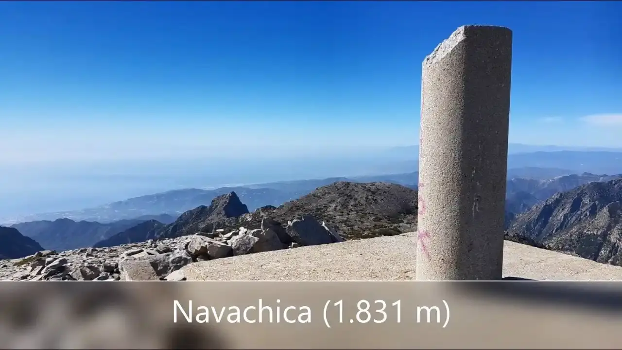
Navachica via the Cazadores Ravine
Trail description
⚠️ A demanding mountain route
It is 7.5 km one way from the Fuente del Esparto with about 1,400 m of ascent, including a stretch up a stream bed, easy scrambles and a steep, loose exit where the path splits into small tracks. There is no reliable water after the spring. In rain, or without mountain experience, don't do it.
Navachica (1,831 m) is the highest peak in the Sierra de Almijara and lies within the municipality of Nerja. This is the classic route, the one in the town hall walking guide: it climbs the Cazadores ravine and the old Mines Path, follows the bed of the Caños del Rey stream and comes out at the Ranchillos del Viento pass, from where a ridge leads to the top. It is shorter and less exposed than the climb via Pico del Cielo and the ridge, but has more pathless stretches.
📥 Take the route on your phone: there is no reliable signal in the ravine.
Map and guide (PDF)GPX trackRoute map
Route facts
- Start
- Fuente del Esparto spring (570 m), 5.8 km from the Nerja Caves along the Pinarillo track.
- Distance
- 7.5 km one way; 15 km there and back from the spring (about 26.5 km from the Caves).
- Ascent
- 1,260 m from the spring to the summit; about 1,400 m in total.
- Time
- 7–8 h there and back from the spring, with short stops.
- Difficulty
- hard work; technically moderate, with easy scrambles and pathless stretches.
- Water
- only at the Fuente del Esparto, at the start.
The route, stage by stage
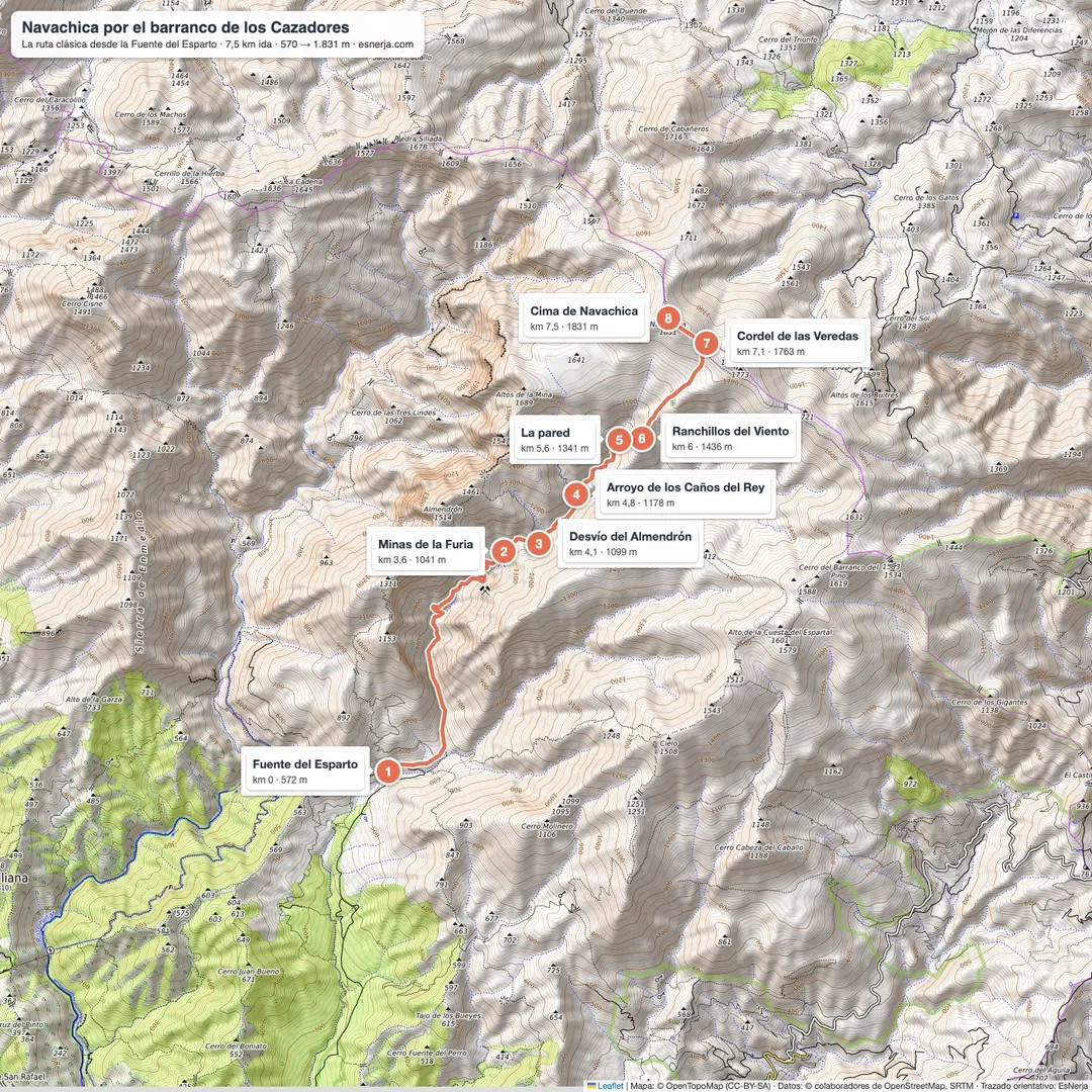
Fuente del Esparto – La Furia mines (km 0–3.6). The track leads to a chain where the Cazadores ravine track begins, between limestone walls with caves once used for livestock. By a rock shelter, the path leaves the bed and zigzags up the loose «chorrera» scree: this is the Mines Path, along which lead and zinc came down. It passes the Mina del Tajo, gets round the wall that blocks the ravine and reaches the adits of La Furia and El Uno. There are open shafts: stay on the path.
Mines – Caños del Rey stream (km 3.6–4.8). At the Almendrón turn-off, marked with a red paint mark, carry straight on. The white top of Navachica shows through the pines. Then leave the path and climb north-east up the bed of the Caños del Rey stream.
The stream bed and the wall (km 4.8–6). The bed climbs in rock steps two or three metres high, easy to scramble up, until it ends at a wall. Exit on the right by a very steep path among holm oaks, loose and full of side tracks: the trickiest part, especially coming down. This is where the Caños del Rey are, caves with standing water that are not a spring.
Ranchillos del Viento – Navachica (km 6–7.5). The Ranchillos del Viento pass opens up the view over the ravine, the Almendrón ridge and the Lomas Llanas pine wood. From there you climb the ridge, with no clear path but with cairns, to the Cordel de las Veredas, where Granada province comes into view and the Pico del Cielo route arrives. The summit, with its trig point, is 400 m away. You return the same way.
Getting to the Fuente del Esparto
From the Nerja Caves car park (paid), along the Pinarillo track: 5.8 km. A barrier closes the track to cars in the fire-risk season, June to October, and in droughts: it stayed shut from April 2023 to November 2024.
Downloads
Sources: Nerja town hall walking guide; Pegaso mountaineering club notes (2013); Málaga provincial council (Gran Senda); walkers' reports (El Jabalí Trepador on Wikiloc); University of Granada Water Institute (Fuente del Esparto); IGN (Navachica trig point, 1,830.72 m). Route drawn by EsNerja from OpenStreetMap and checked against a GPS track of the route. Reviewed in November 2026.
📈 Perfil de elevación
Along the way
22 points, in walking order. In route mode each one pops up as you reach it, even without coverage.
Warnings
Recommendations
Frequently asked questions
Keep exploring
Distance
15.1 km
Time
7h 30min
Elevation +
1400 m
Elevation −
1400 m
Max alt.
1831 m
Min alt.
570 m