
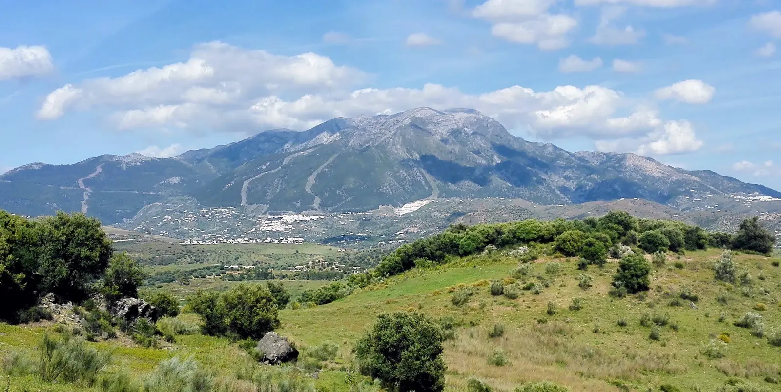
La Maroma – Rooftop of Málaga
Trail description
La Maroma, standing at 2,069 metres above sea level, is the highest point in the province of Málaga and the tallest summit in the Sierras de Tejeda, Almijara and Alhama. The ascent from the southern slopes — starting from Canillas de Aceituno or Sedella — is one of the most sought-after mountain routes in southern Spain.
The trail passes through several distinct bioclimatic zones: beginning among the almond and olive groves of the lower slopes, climbing through dense holm oak forests, and eventually reaching the high-mountain grasslands and rocky outcrops near the top. In the final few hundred metres, the landscape takes on an almost lunar quality, with bare rock and low-creeping vegetation.
From the summit, on a clear day, the views are breathtaking: the Mediterranean shimmers to the south, the peaks of Sierra Nevada rise to the east, the Granada plain stretches out to the north, and on the clearest of days, the silhouette of the Rif Mountains in northern Africa appears on the horizon.
This is a long and demanding route that requires excellent physical fitness and prior mountain experience. In winter, snow and ice are common at higher elevations, making crampons and an ice axe essential.
How to get there
Starting point: El Robledal, Canillas de Aceituno
Parking: Parking at the El Robledal area, Canillas de Aceituno. Access via forest track.
Open in Google MapsWarnings
This is a highly demanding high-mountain route (20 km, 1,600 m elevation gain). Snow and ice are possible in winter — crampons and an ice axe may be required. Do not attempt in fog or stormy conditions. Mobile phone coverage is limited for much of the route. La Maroma is approximately 45 minutes by car from Nerja.
Recommendations
This route is suitable for experienced hikers in excellent physical condition only. Set off very early — before dawn in summer. Carry a minimum of 3 litres of water. Bring warm layers even in summer, as the summit can be cold. A GPS device or topographic map is essential. Always let someone know your planned route before you head out.
Points of interest
Vértice geodésico La Maroma
Highest point in Málaga province at 2,069 meters
summitEncinar centenario
Forest of large centuries-old holm oaks on the north slope
forestFrequently asked questions
Keep exploring
Distance
20.0 km
Time
8h
Elevation +
1600 m
Elevation −
1600 m
Max alt.
2069 m
Min alt.
500 m